Mercian Archaeological Services CIC are proud to be running the Sherwood Forest National Nature Reserve Archaeology Survey.
As home to the Major Oak, Legendary hideaway of Robin Hood, the Sherwood Forest National Nature Reserve is famous around the world!
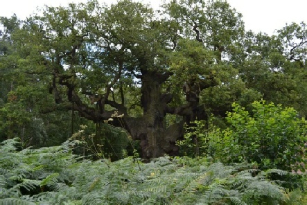
Picture: The Major Oak in The Sherwood Forest National Nature Reserve.
© Mercian Archaeological services CIC.
The National Nature Reserve is actually in two main parts, the ancient woodlands of Birklands and Bilhaugh to the south -
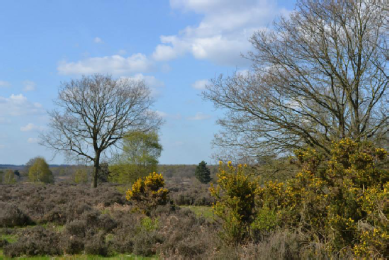
Photo: Budby South Forest, The Sherwood Forest National Nature Reserve. © Mercian Archaeological services CIC.
In medieval times Sherwood Forest was characterised by these two landforms of woodland and heath. There were areas of woodland, grazed wood-
The landscape of the Sherwood Forest National Nature Reserve was also used by people to graze animals and at times to grow crops during the medieval period.
This survey will search not only for evidence of medieval activity, but will also investigate the landscape from Prehistoric and Roman times through to the more recent activity in the Second World War and the use by the army.
Birklands Wood was Crown woodland in the heart of Sherwood Forest in medieval times, and is home to nearly 1000 veteran Oak Trees, and Budby South Forest is the largest area of lowland heath in the Midlands.
The wider landscape:
The survey by Mercian Archaeological Services CIC covers not only the ancient woodlands of Birklands and Bilhaugh, and the ancient heath land of Budby South Forest within the Sherwood Forest National Nature Reserve (SFNRR), but also covers the adjacent woodland of Western Birklands (managed by Forestry England), the southern section of Thoresby Park South of the River Meden (the northern area is currently surveyed separately by Mercian), The area around Thynghowe and Hanger Hill on the north-
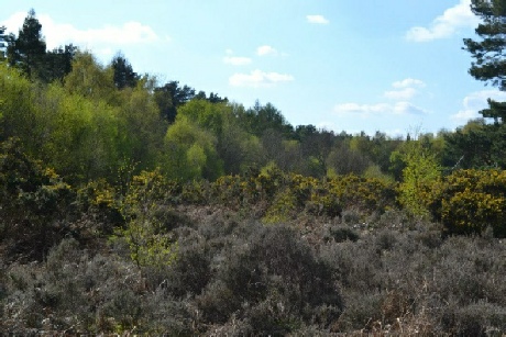
Photo: Budby South Forest, The Sherwood Forest National Nature Reserve. © Mercian Archaeological services CIC.
 The Sherwood Forest National Nature Reserve Archaeology Survey is a long-
Mercian Archaeological Services as a Community Interest Company provides opportunities for different groups and individuals to experience their Local Heritage together...
See the Sherwood Forest Archaeology Project page for further details.
The Sherwood Forest National Nature Reserve Archaeological Survey:
The project seeks to map, record, interpret and help to protect the archaeological resource in the ancient woods of Birklands and Bilhaugh and the ancient heathland of Budby South Forest.
The project includes:
- Level 1 archaeological survey (photographic record GPS locations, measurements, description of features detected)
- level 2 (high level 2D and 3D survey using a combination of survey graded GPS and Total Station)
- Photogrammetry (3D photographic modelling)
- LiDAR data ground-
truthing - Geophysical survey
- Desk-
based assessment - Historic mapping
- Landscape analysis
- Digital terrain modelling
- And more
To date in excess of 600 archaeological features have been recorded by Mercian and a fantastic team of volunteers, setting an example of the brilliant results that can come from professional and community collaboration-
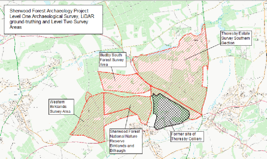
Picture: The Sherwood Forest National Nature Reserve Archaeological Survey. Contains Ordnance Survey data © Crown copyright and database right 2020.
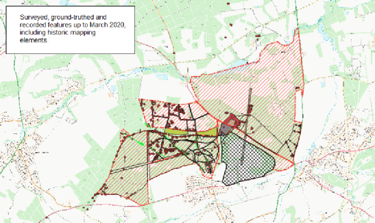
Picture: Preliminary results from The Sherwood Forest National Nature Reserve Archaeological Survey. Contains Ordnance Survey data © Crown copyright and database right 2020.
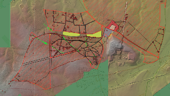
Picture: Preliminary results from The Sherwood Forest National Nature Reserve Archaeological Survey. The image is a LiDAR Composite DTM -
Management of the Archaeological resource:
As well as forming part of long-
The project in Birklands has been undertaken from 2018-
The survey in Budby South Forest was undertaken with support from the RSPB who have managed the site there since 2015.
https://www.visitsherwood.co.uk/
Community Archaeology -
Sadly this seasons fieldwork has come to a premature end, however we will update you as to how you can become involved again.
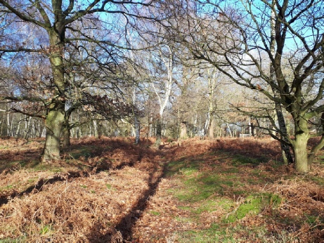
Picture: Possible medieval holloway in Birklands wood recorded as part of the project using survey grade GPS and total station to create 2D maps and 3D models. Birklands wood, in the Sherwood Forest National Nature Reserve.
© Mercian Archaeological services CIC
For more information about joining the project please email info@mercian-
Some photographs from previous seasons:
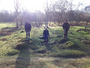 Picture: Recording a military pit in Birklands Wood in the Sherwood Forest National Nature Reserve.
© Mercian Archaeological services CIC.
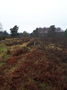 Picture: Recording a linear bank on Budby South Forest in the Sherwood Forest National Nature Reserve. Mercian Archaeological services CIC.
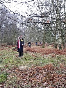 Picture: Recording a linear bank on Budby South Forest in the Sherwood Forest National Nature Reserve.
© Mercian Archaeological services CIC.
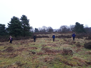 Picture: Recording ridge and furrow on Budby South Forest, Sherwood Forest National Nature Reserve.
© Mercian Archaeological services CIC.
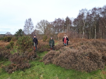 Picture: Recording a military pit on Budby South Forest in the Sherwood Forest National Nature Reserve.
© Mercian Archaeological services CIC.
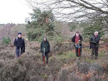 Picture: Recording a linear bank and ditch on Budby South Forest in the Sherwood Forest National Nature Reserve.
© Mercian Archaeological services CIC.
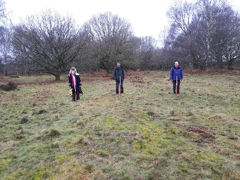 Picture: Recording a linear bank on Budby South Forest in the Sherwood Forest National Nature Reserve.
© Mercian Archaeological services CIC.
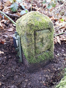 Picture: Edwinstowe boundary stone with carved letter ‘E’ in Birklands Wood in the Sherwood Forest National Nature Reserve.
© Mercian Archaeological services CIC.
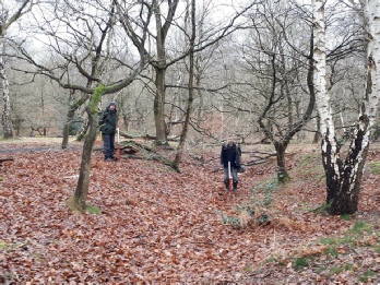 Picture: Recording a medieval holloway in Birklands Wood in the Sherwood Forest National Nature Reserve.
© Mercian Archaeological services CIC.
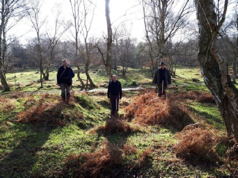 Picture: Recording a military pit in Birklands Wood in the Sherwood Forest National Nature Reserve.
© Mercian Archaeological services CIC.
Archaeological Reports:
All reports from the Sherwood Forest National Nature Reserve Survey are made available for FREE o the community via the links below (as they become available).
The reporting and dissemination of archaeological work is essential and all reports are logged via the OASIS archaeological database and Archaeological Data Service, and logged with the Historic Environment Record for Nottinghamshire.
The following reports form part of a long-
2018 Season:
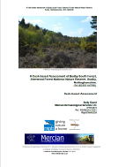 A Desk-
Andy Gaunt, 2018.
http://www.mercian-
The RSPB have been managing the site of Budby South Forest since 2015. This report was commissioned by the RSPB to provide a greater understanding of the archaeological resource within Budby South Forest SFNNR and to aid in the management of the site.


Community Archaeology Nottinghamshire, Community Archaeology Derbyshire, Community Archaeology Leicestershire, Community Archaeology East Midlands, Mercian Archaeological Services Community Archaeology for Nottinghamshire, Derbyshire, Sherwood Forest, Leicestershire and the East Midlands. Community Archaeology Nottinghamshire, Community Archaeology East Midlands, Community Archaeology Leicestershire. Archaeological

The Sherwood Forest National Nature Reserve Archaeology Survey
The Future of Sherwood’s Past
Project page links:
-
-
-
-
-
-
-
-
The Sherwood Forest
National Nature Reserve Archaeology Survey
-
Long term Research at
King John’s Palace:
Ancient Royal Heart of Sherwood Forest
-
The Sherwood Forest Archaeology Training Fieldschool
-
“Scirwuda-
Ghost and Shadow woods of Sherwood Forest Project
-
Investigating Thynghowe Viking
Meeting Site
-
Searching for the
The Battle of Hatfield
-
-
Fieldswork at St Edwin’s Chapel
-
St Mary’s Norton-
-
Mapping Medieval Sherwood Forest
-
The Sherwood Forest LiDAR
Project
-
Warsop Old Hall
Archaeological Project
-
The Sherwood Villages Project:
Settlement Development in the Forest
-
-
-
Researching Edward IIs fortification at Clipstone Peel
-
-
-
-
The Cistercians of Rufford Project:
Settlement Development, Dynamics and Desertion.
-
Sherwood Forest Environmental Survey
-
World War II in Sherwood Forest -
-
World War I in Sherwood Forest -
-
About Medieval Sherwood Forest
-
Robin Hood and Sherwood Forest
-
-
-
-
-
-
-
-
-
-
-
-
Community Archaeology in Derbyshire
Community Archaeology in Leicestershire
Community Archaeology Nottinghamshire, Excavation, Research, Volunteering, Community Archaeology Derbyshire, Training, Social, Learning, Community Archaeology Leicestershire, Heritage, Involvement, Belonging, Knowledge sharing, Community Archaeology Lincolnshire, Topographic Survey, Talks and Presentations, Outreach, Archaeology Projects , Open Days, Schools, Finds Processing, Day Schools, Field Schools, Young People, Archaeology and History of Sherwood Forest, Pottery Research, Medieval, Roman, Prehistoric, Community Interest Company, Community Archaeology Nottinghamshire.
Community Archaeology in Nottinghamshire
Community Archaeology East Midlands
Community Archaeology in Lincolnshire
Community Archaeology in Yorkshire
Mercian Archaeological Services CIC
Specialists in Community Archaeology, Public Involvement, Research & Training
© Mercian Archaeological Services CIC 2024. Registered Business No. 08347842. All Rights Reserved.


