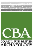
Does the Heritage of the Welbeck Estate Include A King Killed At Cuckney ?

Visitors since 7th November 2013
Mercian Archaeological Services CIC
Community Archaeology in the East Midlands,
Community Archaeology Nottinghamshire, Excavation, Research, Volunteering, Community
Archaeology Derbyshire, Training, Social, Learning, Community Archaeology Leicestershire,
Heritage, Involvement, Belonging, Knowledge sharing, Community Archaeology Lincolnshire,
Topographic Survey, Talks and Presentations, Outreach, Archaeology Projects , Open
Days, Schools, Finds Processing, Day Schools, Field Schools, Young People, Archaeology
and History of Sherwood Forest, Pottery Research, Medieval, Roman, Prehistoric, Community
Interest Company, Community Archaeology Nottinghamshire.
© Mercian Archaeological Services CIC 2013. Registered Business No. 08347842. All Rights Reserved.
Community Archaeology in Nottinghamshire
Community Archaeology in Derbyshire
Community Archaeology in Leicestershire
Community Archaeology East Midlands
Community Archaeology in Lincolnshire

Summary of the fieldwork:
In 1951 during underpinning works at Cuckney Church a large number of burials, all stated to be male, were found in a series of pits beneath the northern part of the parish church (Barley 1951).
The bodies were dug up, and subsequently re-
In 1977 Stanley Revel proposed a theory based on place name evidence that the burials may instead be from the Battle of Hatfield fought in 632/633AD by the forces of King Edwin of Northumbria, against an alliance between Cadwallon of Gwynedd, and King Penda of Mercia (Revill 1975).
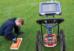
As part of a Heritage Lottery Funded project: Does the Heritage of the Welbeck Estate Include A King Killed At Cuckney? The Battle of Hatfield Investigation Society employed Mercian Archaeological Services CIC to lead an archaeological investigation to locate the possible burial pits, locate the possible reinterments from 1951, and to further interpret the site, earthworks and landscape; which includes the above mentioned medieval castle of Cuckney. This report contains the results of the integrated archaeological survey overseen by Mercian Archaeological Services CIC, which included a geophysical magnetometer survey and a topographic earthwork survey by Mercian, and a ground penetrating radar survey by RSK Geophysics. The Ground Penetrating Radar survey detected annomalies under the church which could represent burial pits, and also found anomalies in the eastern part of the churchyard which could represent the re-
During the surveys; two late Saxon pottery sherds were recovered from the site, one just to the east of the present church and the other approximately directly 215m west of the first, within the valley of the Poulter. These sherds represent the first archaeological evidence for late Saxon activity in Cuckney.
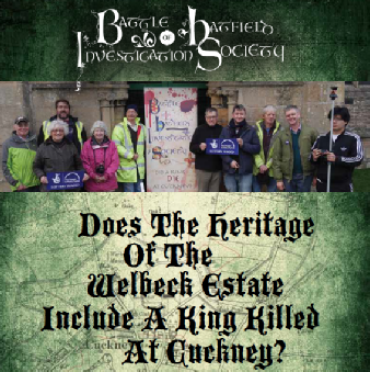
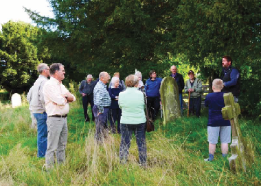
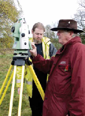
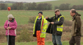
The project was designed an undertaken as a community archaeology project with volunteers receiving training and experience in archaeological techniques, learning about local heritage, and helping with the survey.
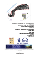
An Integrated Archaeological Survey of Cuckney Churchyard, Castle, and surroundings.
Cuckney, Nottinghamshire, 2016. Archaeological Report [94.9MB].

Download the Report here:
Geophysical Magnetometer and Topographic Surveys of Cuckney Churchyard, Castle, and surroundings.
Cuckney, Nottinghamshire, 2016. Archaeological Report. [5.83MB]
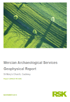
Andy Gaunt
RSK Geophysics
Ground Penetrating Radar Survey Report
Cuckney, Nottinghamshire, 2016. Archaeological Report. [8.39MB]
Other reports:
(also in Appendices of main report above)
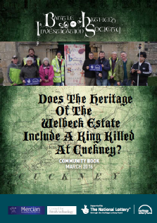
Mercian are very proud to announce the successful completion of our recent Heritage Lottery Fund sponsored project which we developed and worked on for the Battle of Hatfield Investigation Society.
Does the Heritage of the Welbeck Estate Include A King Killed At Cuckney ?
The project began with a launch BBQ on the 17th July 2015 and completed on the 31st March 2016 with the submission of the Archaeological reports from Mercian and lots of paperwork from BOHIS!
The project culminated in November 2015 with two weeks of fieldwork where Geophysical surveys and topographic surveys were conducted with the community to record the earthworks of the castle, and to search for burials possibly associated with the Saxon Battle of Hatfield fought in the year 633 between the armies of Mercian and Gwynedd, against King Edwin of Northumbira, who died in the battle.
Results from the project are available in the archaeological report below.
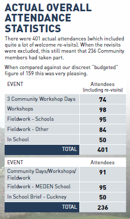
The project was a huge success with a large amount of community involvement including 401 attendees at a mixture of Community workshop days, workshops, Fieldwork, and school sessions…
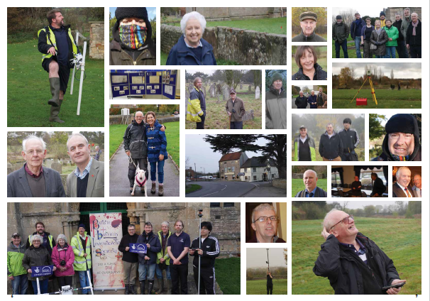
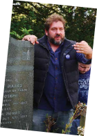
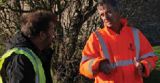

All photographs come from the community project book by BOHIS chairman Paul Jameson available FREE as part of the project (click on the book)
Mercian would like to thank everyone who has been involved in this project including:
All the fantastic volunteers who came and joined in…
The school children, teachers and helpers at Meden Vale, and Cuckney Church of England Primary Schools,
All those who attended workshops, meetings and presentations throughout the project…
We would also like to thank the Battle of Hatfield Investigation Society for all their hard work, and in particular the Chairman Paul Jameson and Honorary President Joseph Waterfall for their boundless enthusiasm, driving force and dedication, having provided hundreds of hours of their time to this project and the overall research of the society…
We also thank Tim Allen Inspector of Ancient Monuments, and Erin Lewis, Business Officer, Historic England.
The Diocese of Southwell & Nottingham.
Rev. Simon Cash and the Parochial Church Council of St. Mary’s Church, Cuckney.
The Welbeck Estate.
Ursilla Spence, Principal Archaeologist, Nottinghamshire County Council, for supporting the project (and providing map from previous church yard survey).
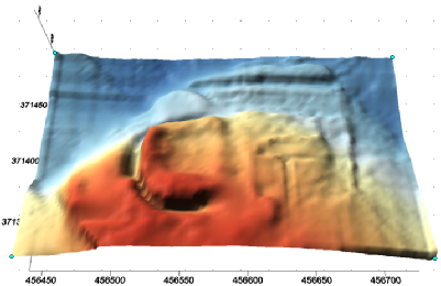
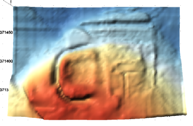
Picture: Digital Terrain Model of the results from the topographic survey of Cuckney Churchyard, castle and surrounds. South is to the top.
© Mercian Archaeological Services CIC, 2016.
Please see the report for details and description.
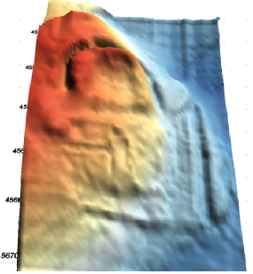
Picture: Digital Terrain Model of the results from the topographic survey of Cuckney Churchyard, castle and surrounds. West is to the top.
© Mercian Archaeological Services CIC, 2016.
Please see the report for details and description.
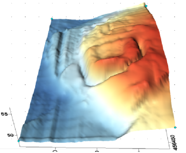
Picture: Digital Terrain Model of the results from the topographic survey of Cuckney Churchyard, castle and surrounds. East is to the top.
© Mercian Archaeological Services CIC, 2016.
Please see the report for details and description.
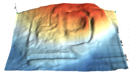
Picture: Digital Terrain Model of the results from the topographic survey of Cuckney Churchyard, castle and surrounds. North is to the top.
© Mercian Archaeological Services CIC, 2016.
Picture: Digital Terrain Model of the results from the topographic survey of Cuckney Churchyard, castle and surrounds. North is to the top.
© Mercian Archaeological Services CIC, 2016.
Please see the report for details and description.
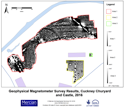
Picture: Results from Magnetometer Survey 2016
Contains OS data © Crown copyright [and database right] 2016.
© Mercian Archaeological Services CIC, 2016.
Please see the report for details and description.
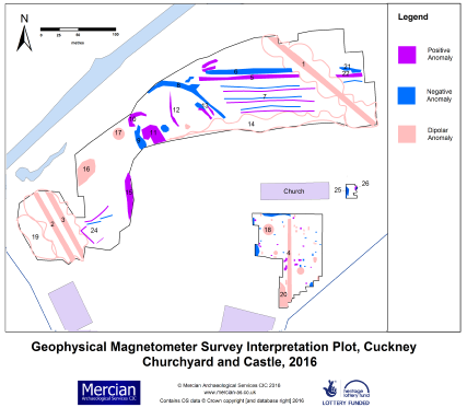
Picture: Interpretation plot of Geophysical Magnetometer survey 2016
Contains OS data © Crown copyright [and database right] 2016.
© Mercian Archaeological Services CIC, 2016.
Please see the report for details and description.
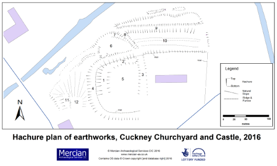
Picture: Hachure plan and map of topographic earthwork survey 2016.
Contains OS data © Crown copyright [and database right] 2016.
© Mercian Archaeological Services CIC, 2016.
Please see the report for details and description.
Some results from the report:
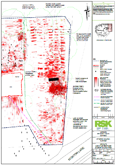
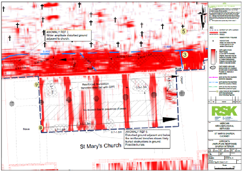
Picture: Eastern half of interpreted results from the Geophysical Ground penetrating Survey, Cuckney 2016.
© RSK Environment Ltd.
Please see the report for details and description.
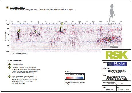
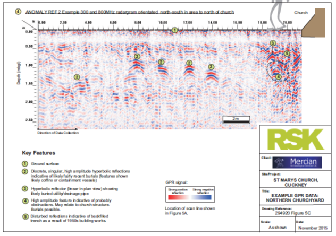
Picture: Results from the Geophysical Ground penetrating Survey, Cuckney 2016.
© RSK Environment Ltd.
Please see the report for details and description.
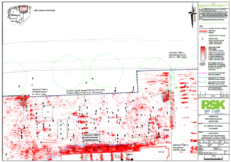
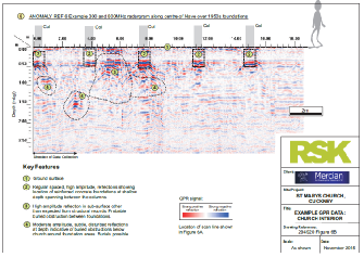
Picture: Results from the Geophysical Ground penetrating Survey,
Cuckney 2016.
© RSK Environment Ltd.
Please see the report for details and description.
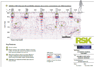
Picture: Results from the Geophysical Ground penetrating Survey, Cuckney 2016.
© RSK Environment Ltd.
Please see the report for details and description.
Picture: Results from the Geophysical Ground penetrating Survey, Cuckney 2016.
© RSK Environment Ltd.
Please see the report for details and description.
Picture: Results from the Geophysical Ground penetrating Survey, Cuckney 2016.
© RSK Environment Ltd.
Please see the report for details and description.
Picture: Results from the Geophysical Ground penetrating Survey, Cuckney 2016.
© RSK Environment Ltd.
Please see the report for details and description.
Picture: Results from the Geophysical Ground penetrating Survey, Cuckney 2016.
© RSK Environment Ltd.
Please see the report for details and description.
Some media coverage of the project:
Sheffield Star Wednesday 30th October 2013
The spot where an Anglo-
King Edwin, who ruled Northumbria, was thought to have been killed at the Battle of Hatfield Chace, north of Doncaster, in 632AD.
Mansfield Chad Saturday 2nd May 2015
A group of archaeologists have made their final bid for a £10,000 investigation to discover whether 200 buried skeletons will prove an ancient battle took place near Warsop.
The Battle of Hatfield Investigation Society (BIOHIS) hopes to rewrite the history of the Battle of Hatfield and relocate the site of the death of Edwin -
Read more: http://www.chad.co.uk/news/local/archaeologists-
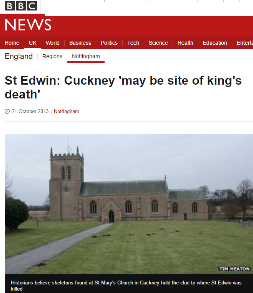
BBC News Tuesday 22nd October 2013
A full excavation of a Nottinghamshire church's grounds could prove where an Anglo-
The Battle of Hatfield Investigation Society believes St Edwin died at Cuckney, near Mansfield in AD632 and not in Yorkshire as has been claimed.
Their theory is based on 200 skeletons found beneath St Mary's Church in Cuckney in 1951.
Read more: http://www.bbc.co.uk/news/uk-
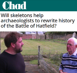
Mansfield Chad Wednesday 2nd October 2013.
With the discovery of the remains of Richard III under a council carpark in Leicester last year and the subsequent row between the city and the people of York about where he should be laid to rest -
Despite the antics of screen archaeologists, it is a meticulous science that relies on the detailed study of artefacts, buildings and local geography to eek out the clues of the past.
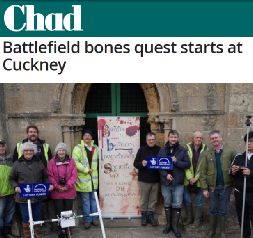
Mansfield Chad Thursday 12th November 2015
A group of archaeologists are a step nearer discovering whether 200 buried skeletons will prove an ancient battle took place near Warsop.
Three shadowy hotspots found by ground penetrating radar could finally have pinpointed the location of the remains which could completely rewrite the history of the Battle of Hatfield.
Volunteers from The Battle of Hatfield Investigation Society (BOHIS) are taking part in the first fieldwork they hope could relocate the site of the death of Edwin -
A whole community including around 100 schoolchildren from Meden and Cuckney Schools are taking part in the eight day project which will examine 1,400 years of the area’s history.
OHIS was recently awarded £15,600 Heritage Lottery Fund (HLF) support to explore and share the history of Cuckney Norton and Holbeck.
Read more: http://www.chad.co.uk/news/local/battlefield-

HLF Award Total:
£15,600
Magnetometer survey
Topographic survey
Ground Penetrating Radar (GPR) survey
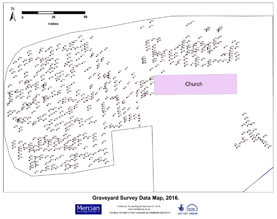
Graveyard Survey
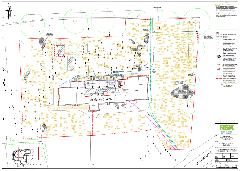
Picture: Gravestone location map, 2016
Contains OS data © Crown copyright [and database right] 2016.
© Mercian Archaeological Services CIC, 2016.
Please see the report for details and description.
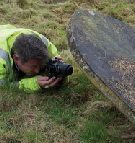
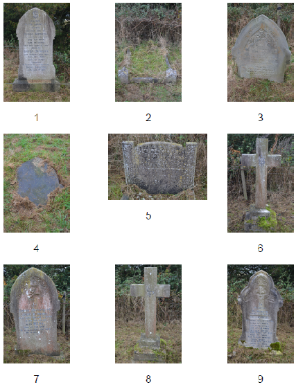
Picture: Example gravestone photographs 2016
Please see the report for details and description.
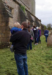
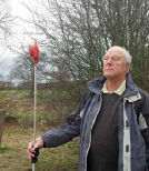
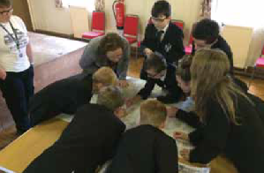
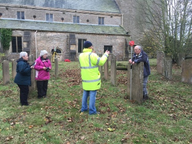
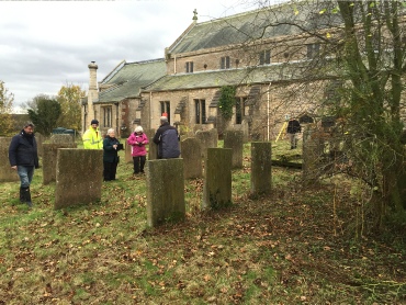
Picture: Volunteers undertaking graveyard survey 2016
Please see the report for details and description.
Picture: Volunteers undertaking graveyard survey 2016
Please see the report for details and description.