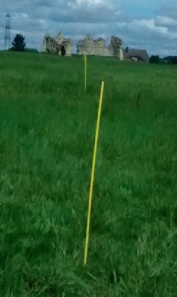
Geophysical Magnetic Survey King John's Palace

Visitors since 7th November 2013
Mercian Archaeological Services CIC
Community Archaeology in the East Midlands,
Community Archaeology Nottinghamshire, Excavation, Research, Volunteering, Community
Archaeology Derbyshire, Training, Social, Learning, Community Archaeology Leicestershire,
Heritage, Involvement, Belonging, Knowledge sharing, Community Archaeology Lincolnshire,
Topographic Survey, Talks and Presentations, Outreach, Archaeology Projects , Open
Days, Schools, Finds Processing, Day Schools, Field Schools, Young People, Archaeology
and History of Sherwood Forest, Pottery Research, Medieval, Roman, Prehistoric, Community
Interest Company, Community Archaeology Nottinghamshire.
© Mercian Archaeological Services CIC 2013. Registered Business No. 08347842. All Rights Reserved.
Community Archaeology in Nottinghamshire
Community Archaeology in Derbyshire
Community Archaeology in Leicestershire
Community Archaeology East Midlands
Community Archaeology in Lincolnshire
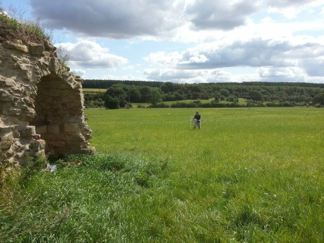
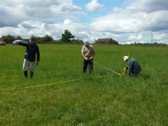
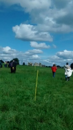
The survey was undertaken as a community archaeology project with volunteers helping to layout grids, and learning about geophysical surveying techniques.
A number of previous geophysical surveys of parts of Castle Field have been undertaken including Resistance survey and Magnetic survey (Masters 2004), and Magnetic survey and Ground Penetrating Radar survey (GPR) (Wessex Archaeology 2011).
These tended to focus on the vicinity of the standing ruins. A resistance survey of the entirety of Castle Field was undertaken in 2010 (Gaunt 2011). This survey among other anomalies identified the medieval boundary of the site on the south-
The 2014 magnetic survey detected many of the features seen in the preceding 2010 resistance survey, including the Northwest to Southeast boundary ditch mentioned above. The magnetic survey detected this anomaly in more detail and the data suggests this
feature has a sinuous ‘reverse s-
the plough lines of a preceding open-
At the time of writing the boundary of the site between the North-
The Pheasantry originally formed part of the 7 1/2 acre palace site up to the flooded lake to the North (Gaunt and Wright 2013; Wright and Gaunt 2014). To the southwest of the medieval boundary ditch is a discreet area of strong magnetic anomalies that may represent an area of burning or perhaps a high temperature industry such as metalworking.
In the southwest corner of Castle Field the survey also revealed a linear anomaly intersecting the boundary ditch and possibly forming an enclosure appended to the exterior of the palace complex.
If this is an enclosure the area enclosed is approximately 1.5 hectares (as seen in the area surveyed) or 3.7 acres. This feature was subsequently examined through excavation to determine its relationship to the boundary of the palace complex as part of Mercian's Summer Field Training School.
The results of this fluxgate gradiometer survey of Castle Field have helped to further understand the extent and complexity of the site. A Ground Penetrating Radar (GPR) survey of Castle Field is planned by Mercian Archaeological Services CIC for 2015.
GPR will further help to map the buried remains and the built environment of the site. It is hoped that a combination of these surveys, and other ongoing work, alongside carefully targeted interventions will help in the further understanding the site.
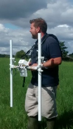
As part of the Sherwood Forest Archaeology Project, Mercian Archaeological Services CIC undertook a Geophysical Magnetic Fluxgate Gradiometer survey of ten acres of Castle Field in August 2014. Castle Field is part of Waterfield Farm, and contains the surviving upstanding remains of the former royal palace at the heart of Sherwood Forest, known in medieval times as the Kings’ Houses, and now known as King John’s Palace.

Report coming soon
